Mark Thurstain03 Nov 2020
As the silence of lockdown descended, many of us found ourselves increasingly aware of the natural world in a way that we hadn't for a long time. Those lucky enough to have gardens became conscious of singing birds and couldn’t quite be sure if there were more of them than last year - or just that we were noticing them properly for the first time in a long time. Parks helped save our sanity for our one hour of daily exercise and as soon as we were allowed, many of us travelled far out of our urban environment to get a solid fix of green and blue.
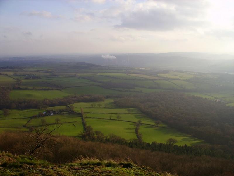
For those briefly escaping England’s cities and large towns, our first hint of large swathes of nature would be the green belt – a ring of protected land designated to restrict urban sprawl. As well as offering the countryside some protection from development, they provide access to open landscape and opportunity for recreational activities.
Yet for many of us, the green belt is not a destination for recreation. Undoubtedly successful in restricting urban sprawl, much of the green belt comprises large swathes of inaccessible agricultural land, private golf clubs, and fenced off woodland.
The benefits of the green belt
While recognising the important community amenity value of green belt land, Friends of the Earth identifies its considerable potential for helping to combat climate change and biodiversity loss through a process of natural habitat regeneration. Key to this process is the planting of more trees, acting as a carbon sink, to reduce flooding, and if cultivated appropriately, to enhance biodiversity.
If these two aspirations – natural regeneration and social amenity - can be brought together in projects in specific locations which we have called Hope Spots then the chances of enhancing and evolving the green belt are significantly improved.
What makes a good Hope Spot?
And how do we find them? Recent Friends of the Earth research has established that some 153,608 hectares (on top of an existing 220,494 hectares) of green belt land in England is suitable for planting trees. That’s a lot of potential locations for community supported natural regeneration. To help refine the search for Hope Spots, Friends of the Earth commissioned us at Geofutures, a data science practice based in the West of England, to bring together a series of maps and data to identify the best Hope Spot locations in Bristol and Bath’s green belt as a pilot project.
Covering the whole of the green belt in trees is not feasible. While the idea of a forest girdle around the two cities might appeal to the romantic in us, the rural landscape has many roles to fulfil, not least to produce food. Planting trees on high grade agricultural land is not an optimal use of the landscape. It makes sense to map where sub optimal agricultural land in the green belt is found including mediocre agricultural land on slopes too steep to cultivate. We also had to ensure that our Hope Spot locations did not include areas of existing bio-diverse habitat, or include areas of allotments or other community food production. A further important consideration was the Hope Spots locations need to be close to centres of population and in particular to communities for whom access to nature is limited.
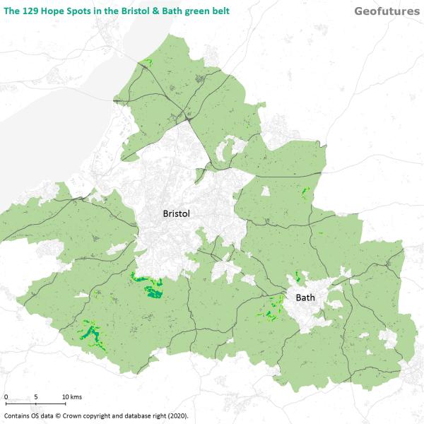
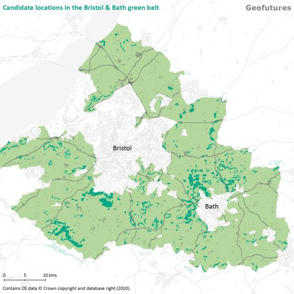
In all, we found 129 Hope Spots in the green belt that satisfied these criteria but finding them took some time. We first had to identify a large set of candidate locations that might be appropriate for planting trees, and then whittle them down to identify the ones best suited to take forward for community support tree planting projects.
Lots of candidate locations for Hope Spots
This mapping exercise revealed just over 2,000 candidate locations within the green belt which fulfilled the basic environmental criteria for tree-planting sites we were looking for. It’s worth noting 120 of these are quite small, having an area of less than 0.25 hectares, or just over half an acre. These shouldn’t be discounted, since smaller locations may be just the place for a community to cut their teeth on a tree planting project.
But 2,000 potential Hope Spots is too large a number to deal with and so we needed to focus in on those that offered the best opportunity for taking forward, which brings us onto the second aspect of the modelling - to review the candidate Hope Spot locations though the lens of the communities who might be best motivated to engage in tree planting and nature regeneration.
What communities should we target for Hope Spot involvement?
We first want to assess the locations in terms of their proximity to residential areas since people tend to be more engaged in projects on their doorstep. Candidate locations close to population are scored more highly. We then further refine the candidate list by assessing proximity to those populations for whom access to greenspace and nature might be more compromised, and for whom Hope Spots may be an important outlet. For example, communities that have little, if any garden space; communities where car ownership is low; communities who are assessed as being deprived; communities who are not near active places or greenspace.
Close to existing woodland
A further important suitability consideration for potential Hope Spot locations is whether they are close to existing woodland. Planting trees in close proximity to existing woodland has a more powerful regenerative effect than planting an isolated patch of new woodland. This factor is also readily added to the mix.
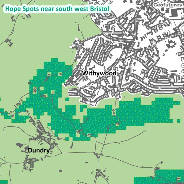
As we draw all these factors together and superimpose them on the candidate locations, we see that some areas are more suitable for Hope Spots than others. By carefully selecting a suitability score threshold, we are able to identify those candidate locations (or areas within larger candidate locations) which are best suited as Hope Spots for community-supported nature regeneration in the green belt - and thereby reduce the list to a more manageable 129.
The full list of Hope Spots can be viewed on this interactive map and supports the next phase of the project. Friends of the Earth plans to explore whether the Hope Spot model is an effective tool for mobilising landowners, local community groups and other stakeholders confident that the designated locations have been optimally identified.
An adaptable approach
The approach we have taken is flexible. We don’t necessarily have to concentrate on identifying Hope Spots for tree planting. The approach can be adapted to other regenerative activity such as biodiversity enhancement or for community food production for example. We can also change the suitability criteria to look at different communities or to put different constraints on the selection process.
But by putting data on the map, we can start to find Hope in the green belt.
For further information about Hope Spots mapping, please contact Geofutures or if you are interested in planting trees on a particular Hope Spot in the Bristol and Bath green belt, please


